How people learn to read a city
A city exists on a map, but people experience it through journeys, familiar places, and partial views. We remember a street that leads toward the river. We recognize a neighborhood by its buildings. A tower tells us where we are before we can read a street sign.
In The Image of the City, first published in 1960, Kevin Lynch asks how urban form supports this understanding. His central argument is that planners should consider the mental images people form of their surroundings. A city should offer recognizable parts and clear relationships between them. This can make daily movement easier and give ordinary places greater emotional depth. The MIT Press description identifies this concern with memorable urban form as the book’s central project.
Lynch develops a vocabulary for describing these images, studies three American cities, and proposes ways to improve their physical clarity. His subject extends beyond finding the shortest route. It includes the pleasure and confidence of knowing where one belongs.
Legibility and imageability
Legibility means that people can recognize a city’s parts and organize them into a coherent pattern. Knowing individual places is insufficient if their relationships remain confusing. Someone might recognize both a station and a public garden yet struggle to explain how to get from one to the other.
Imageability describes the capacity of physical form to evoke a strong mental image. Shape, color, arrangement, and contrast can make a place distinctive. Lynch uses the two concepts closely together: recognizable features help people build an understandable whole. His opening discussion also connects clear environmental images with emotional security and richer experience.
A mental image need not reproduce a survey map. It must support useful action and allow further learning. People build it through an exchange between their surroundings and their own attention, memory, and experience. Familiarity can make a modest feature meaningful, while a newcomer may overlook it.
Lynch separates three aspects of an environmental image. Identity allows us to distinguish something from its surroundings. Structure locates it in relation to the observer and other things. Meaning concerns its practical or emotional importance. He concentrates on identity and structure because these offer a more manageable basis for studying physical design. He acknowledges meaning without claiming that a planner can prescribe it for everyone.
What the three city studies reveal
Lynch’s team combined field observation with resident interviews in central areas of Boston, Jersey City, and Los Angeles. Observers examined visible features and their connections. Interviewees described places, drew sketch maps, and explained imagined journeys. Additional work in Boston included recognition tests and actual trips. The method compared what a trained observer saw with what residents remembered.
Boston offered strong character alongside confusing connections. Boston Common, Beacon Hill, the Charles River, and the gold-domed State House supplied vivid reference points. Yet crooked streets made it difficult to relate some of these places to one another. The lesson is that distinct parts do not automatically create a clear structure.
Jersey City exposed a different difficulty. Rail facilities, industrial areas, and changes in terrain divided the city. Some features stood out, including Journal Square and the Medical Center on the cliff. Much of the surrounding fabric supplied fewer widely shared reference points. People could learn their routes without gaining an equally vivid sense of the larger place.
Los Angeles showed the limits of regular geometry. Its downtown grid offered an organizing pattern, but repeated streets could be difficult to distinguish. Larger routes and the experience of driving also shaped people’s images. A plan that looks orderly from above can still lack useful differences at the scale of a journey.
These are observations from the places and period Lynch studied. They should not become permanent judgments about the cities as they exist today. The studies matter because they reveal different ways that recognition and spatial understanding can come apart.
Five elements of the city image
Lynch organizes the physical content of city images into five recurring elements. They describe how people perceive a place; they are not a list of objects that every development must install.
Paths: the routes that organize experience
Paths are the channels along which people move, including streets, walkways, transit lines, and canals. For many observers, they provide the main framework of the city image. Other features appear along them and become connected through movement.
A path becomes easier to remember when it has continuity and a distinctive character. Trees, building fronts, width, or a consistent activity can help. Its direction and endpoints also matter. A memorable stretch of street offers limited guidance if a traveler cannot tell where it leads.
Edges: boundaries that divide or connect
Edges are linear boundaries that people perceive without primarily using them as routes. Shorelines, railway cuts, walls, and abrupt changes in development can serve this role. They help define areas, but they can also fragment the city image.
Lynch distinguishes an edge that acts as a barrier from one that acts as a seam. A boundary can support contact between neighboring areas when crossings, views, and activities connect its sides. Clarity does not require isolation.
Districts: areas with a recognizable character
Districts are areas that people mentally enter and recognize through shared qualities. Building types, materials, uses, topography, and patterns of activity can give them an identity. Their boundaries may be sharp or gradual.
A district needs enough consistency to be recognized, but this does not imply identical buildings. Beacon Hill illustrates how many features can combine into a shared character. Internal variety can coexist with a clear sense of place.
Nodes: places where activity or movement concentrates
Nodes are strategic points that people can enter, such as junctions, transfer points, squares, or concentrated centers of activity. They often become anchors for surrounding districts.
Their importance comes partly from decisions. At an intersection or transport transfer, people must attend to their surroundings and choose what comes next. A node works better when its entrances, exits, and relationship to nearby routes are understandable.
Landmarks: reference points seen from outside
Landmarks are external reference points. Towers and prominent buildings can serve this function, but so can a shopfront, sign, tree, or small architectural detail. Their usefulness depends on contrast, location, visibility, and the observer’s familiarity.
A landmark differs from a node because the observer uses it as a reference rather than entering it as a strategic place. The distinction concerns perception. The same physical feature may take different roles for different users.
Relationships matter more than a checklist
The five elements reinforce or weaken one another. A landmark can identify a node. A path can explain how to reach it. A district can give the journey a recognizable setting. An edge can help travelers understand which side of the city they occupy.
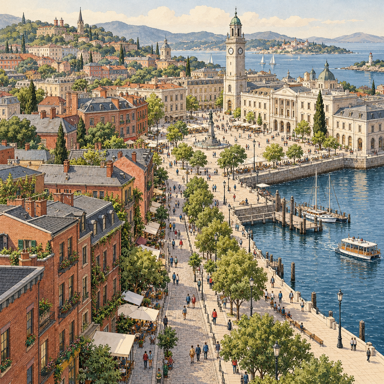
Consider an illustrative journey, rather than a case from the book. A visitor follows a tree-lined street through a brick neighborhood, reaches a square beneath a clock tower, and turns toward the waterfront. Each feature contributes to a connected image. An isolated tower would provide less help if the routes around it remained unclear.
Lynch also emphasizes that perception changes with movement, scale, and experience. A broad road might be a driver’s path and a pedestrian’s edge. A place visible across the city may orient a distant traveler, while small details guide someone who knows the neighborhood well. Design must account for these changing relationships.
Designing for understanding without removing discovery
Lynch proposes strengthening the existing urban image through clearer paths, recognizable transitions, connected nodes, and distinctive features. He gives attention to continuity, directional clues, visibility, and the sequence of experience. A city unfolds over time, so its design cannot be assessed from a single viewpoint.
This does not require making every place immediately obvious. Lynch allows room for surprise and exploration within a dependable larger framework. A strong image should accommodate new discoveries and physical change. Excessively rigid order could narrow experience and make adaptation harder.
His design process begins with analysis of the place and its inhabitants’ images. It then develops proposals that can be reconsidered through use and further inquiry. The planner’s drawing is one contribution to an ongoing city, whose many users and builders continue to change it.
A practical application is to study one difficult journey before proposing a major redesign. Ask different users to describe it. Walk it, identify uncertain turns, and compare their accounts. Then examine whether clearer connections, visible destinations, or more recognizable decision points would help. This is an application of Lynch’s approach, not a procedure proven by his pilot studies.
Limits of the lens
Lynch openly identifies weaknesses in his evidence. The main interview samples were small and favored middle-class professional and managerial participants. They could suggest shared images but could not establish a representative image for each city’s whole population. The book’s methods appendix calls for larger, more representative studies and better ways to examine relationships among elements.
The focus on visual form also leaves substantial questions outside the analysis. As a critical reading, a place can be memorable yet unaffordable, inaccessible, or socially exclusionary. A clear boundary can improve orientation while separating communities. Lynch’s concepts help describe physical experience, but they cannot alone decide whether an urban project serves the public.
Applying the method today therefore requires attention to whose images are being collected. Children, newcomers, people with different disabilities, and people traveling by different means may need different cues. These are implications for responsible use of the framework, rather than findings established by the original samples.
The book gives readers a precise way to notice how cities become understandable. Its strongest contribution is the link between physical form and lived perception. Better urban design begins by asking how recognizable places connect in people’s experience, then testing whether proposed changes make that experience clearer and richer.
Sources
- MIT Press: The Image of the City — verified title, sole author credit, original publication year, and scope.
- Kevin Lynch: The Image of the City, university-hosted scan — primary text, especially the three city studies, the five elements, design proposals, and Appendix B on methods and limitations.
- University of Toronto: excerpts from the opening chapter — definitions and discussion of useful environmental images.
